List of Projects
Asia, Azerbaijan
Aerial mapping and classification of the country’s agriculture growths, covering an area in excess of 40,000sqkm.
Africa, Burkina Faso
Satellite mapping of the country funded by the World Bank.
Africa, Sao Tome
Aerial mapping, orthophoto and ground measurements of 2 islands in the Atlantic Ocean, financed by the World Bank.
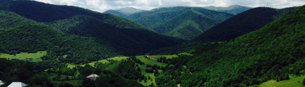
Asia, Georgia
A number of aerial mapping projects, aerial LiDAR and orthophoto for agriculture, financed by the World Bank.
Africa, South Africa
Flight of special sensors.
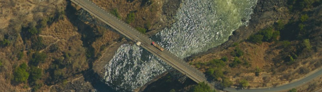
Africa, Zambia
A number of projects for an aerial LiDAR mapping of the Zambezi River and orthophoto from accurate aerial photographs of large parts of the country.
Europe, Greece
Aerial mapping of the ATTICA peninsula for the construction of a new airport.
America, Dominican Republic
Aerial photography project in cooperation with a large Israeli infrastructure company.
Africa, Eritrea
A number of aerial photography projects of the country's main cities in cooperation with the Israeli Ministry of Foreign Affairs.
Europe, Spain
Multivision mapping of Catalonia province funded by the Spanish government.
Asia, Georgia
Aerial photography, mapping, orthophoto, color aerial photography for mapping of oil pipeline from Georgia to Azerbaijan, covering 1,700 km, mapping and orthophoto of 9,000 stereoscopic models.
America, Honduras
Photogrammetry mapping, orthophoto and GIS for disaster area monitoring in Honduras. Air photography at a scale of 1: 20,000, 1: 40,000. Coverage of 60 states. DGPS, GPS measurements and ground survey. Photogrammetric mapping on a scale of 1: 50,000 and 1: 5,000, orthophoto on a scale of 1: 5000- 50 cm GSD edit to GIS format.
Europe, Romania
Aero 7 Project (a project partially funded by the World Bank) Aerial photography on a total area of 57,000 square kilometers and orthophoto mapping at various scales. Creation of a digital base and new maps.
Europe, Romania
Aerial photography, orthophoto, photogrammetry mapping. Aero 5 Project (a project funded by the World Bank). Aerial photography on a total area of 24,000 sq km and orthophoto mapping on various scales. Creating a digital database and creating new maps.
Africa, Ethiopia
Aerial photography, orthophoto, photogrammetrical mapping of Lake Tana. Aerial photography, orthophoto and mapping on a scale of 1:2,000 and 1:1,000.
Africa, Burkina Faso
Satellite imagery Satellite photography and their processing to orthophoto based on DTM and control points at a total area of 45,000 square kilometers.
Africa, Uganda
Digital photogrammetry mapping - Photogrammetric mapping of Kampala and its surroundings as part of a comprehensive urban and transportation planning project of the municipal authority.
Africa, Uganda
GIS Training - GIS courses for urban planners from the Ministry of Land, Housing and Urban Development in Kampala, Uganda.
Africa, Zambia
Laser mapping of the Zambezi River basin and the provision of accurate and detailed topographical information of the region's coverage in conjunction with high-resolution orthophoto. The information served as the basis for hydrological models for flood forecasting, as well as a tool for managing the water sector for the development of infrastructures throughout the country, such as dams and canals, as well as for the construction of hydroelectric power plants to solve the energy problem throughout the country.
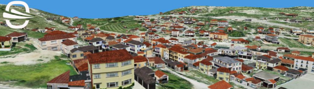
Europe, Cyprus
3D mapping and modeling - topographic mapping and modeling of the island structures to establish a database for attribution of land ownership and collection of taxes.
Africa, Zambia
Mapping, aerial photography and laser mapping - high resolution mapping of populated and uninhabited areas throughout the country to lay the foundation for the establishment of a new database for the Government Land Office, for the purpose of land allocation, development and planning, improving collection and better efficiency management of land throughout the country.
Africa, Angola
Mapping using satellite images of agriculture farms in Angola to map farm boundaries, existing elements, elevation lines and DTM of all farmland.
Middle East, Jordan
Aerial photographing and mapping of Dead Sea salt and potash pools, to prevent fungus and improve the flow of water between the pools, analyzing the situation of the sinkers at the area for forecasting and preventing the collapse of the sand piles located near the pools.
International Markets
Over the years, Ofek Aerial Photography has acquired a vast experience in executing major projects worldwide in the fields of aerial photography, mapping, GIS and geographic applications. We worked in Ghana, Uganda, Burkina Faso, Ethiopia, Sao Tome, Zambia, South Sudan, Angola, Romania, Greece, Cyprus, Germany, England, Spain, Georgia, Azerbaijan, Kazakhstan, USA, Costa Rica and Honduras.
The projects performed by the company reflect its high capabilities in carrying out complex international aerial photography, aerial LiDAR, mapping, surveying and orthophoto creation at various scales.
Ofek Aerial Photography’s advanced capabilities are also reflected in the establishment of information systems and GIS systems and in the implementation of training and teaching at a very high level in various parts of the world. Ofek specializes in projects in developing countries and offers comprehensive solutions that meet the unique requirements and needs of these countries.
Developing Countries
Ofek Aerial Photography specializes in performing projects in developing countries and offers comprehensive solutions that meet the unique requirements and needs of these countries.
Ofek assists developing countries in setting up a geographic information system, and provides, inter alia, the following services:
- Establishment of a local center for mapping and GIS – an activity that includes training of the Center’s staff on GIS, photogrammetry, image processing and more.
- Collect geographic information in different resolutions and scales using a variety of sources such as aerial photography, satellite imagery and ground mapping.
- Practical expertise and field advice to ensure successful implementation of the program. This activity includes presenting the plan to the relevant decision makers and senior government officials, and an explanation of the great benefit of this program. We also assist the Center’s directors in initiating specific projects and advising on the further development and expansion of the program.
Success stories