The government of Cyprus had a goal – to boost their revenue and make informed decisions on municipal taxes. To achieve this, they embarked on a comprehensive island-wide mapping project, utilizing aerial photography, photogrammetric mapping, and LIDAR scans.
Their mission was no small feat, covering a vast area of 6,200 square kilometers and cataloging roughly 500,000 buildings. The objective was clear: to determine municipal taxes with precision.
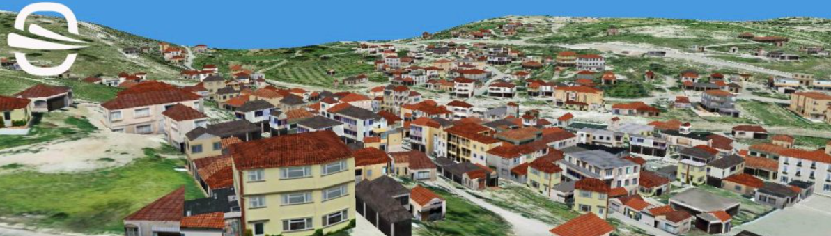
This ambitious project involved three essential flight components. Vertical aerial photography provided a bird’s-eye view of Cyprus, building mapping left no structure undocumented, and Digital Terrain Models (DTM) and Digital Surface Models (DSM) offered insights into the island’s landscape.
The project employed two flight methods. One relied on advanced camera systems to capture both vertical and oblique images, while the other used LIDAR technology to create a detailed laser point cloud of data.
Challenges arose, particularly near the sensitive demilitarized zone separating Greek Cyprus from Turkish Cyprus. Despite hurdles, the project prevailed, thanks in part to Ofek’s Camera System, renowned for its long-distance capabilities.
The result of this collective effort is a vast database of 3D building images. These images enable precise measurements for various aspects of taxation, including building size, garden dimensions, and potential violations.
This mapping project has equipped the government with the data they need to make informed decisions about municipal taxes. Looking ahead, the future holds promise for improved revenue in Cyprus.
Join us on this journey, where innovation and precision come together to create a brighter, more financially secure future.