The system offers many uses and applications to the designer, engineer, operations manager and project managers.
For demonstration and experience click here
System Components
- 6 360 ° wide-angle cameras, 15 frames per second per camera.
- 3 SICK LiDAR scanning systems.
- Differential GPS + IMU + (rotary wheel meter) for precise positioning determination.
- Computers and peripherals.
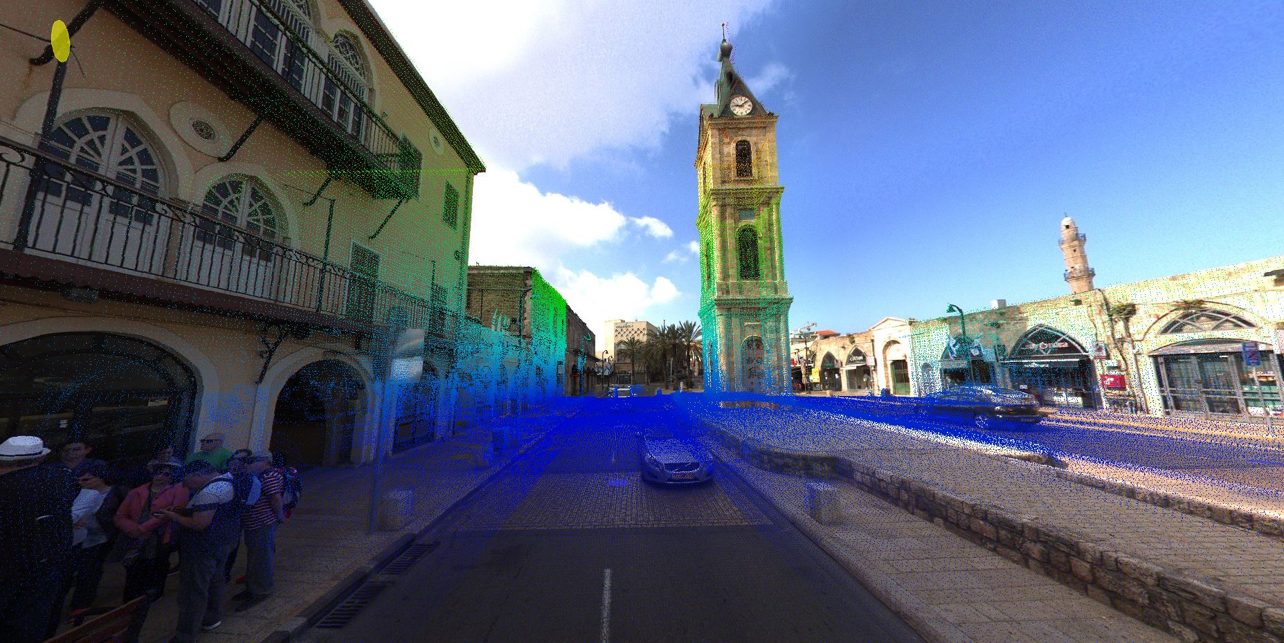
Systems’ Outcomes
- An exact travel route made in a simple and efficient process for the user.
- Panoramic Photography allows for a wide orientation in space.
- A three-dimensional laser point cloud – allowing exact measurements to be made across the image.
- Automatic detection of objects along the way – columns, signs, road signs, etc.
- The formation of GIS entities allows precise positioning determination.
Systems’ Benefits
- Collecting information on the way / road while driving quickly. Geo-info is anchored!!
- Shortening the time of data collection and delivery to the customer while maintaining unprecedented geographical accuracy!
- A simple and easy to use interface that connects easily to all known GIS systems.
- Flexibility and maximum adaptability to customer needs and systems.
Uses and Applications
Local Municipalities
- Street surveys – quick photographic coverage of the streets in the city as well as “On Line” laser mapping in the shortest time and with high resolution.
- Immediate connection – to the GIS systems and management systems of the local authority.
- Automatic mapping – precise and very detailed for the facades of buildings in the streets, signage, gardening, road condition, fences, separation walls, street lighting and more.
Maintenance of roads
- Inventory surveys – of road and advertising signs, accurate position of each sign, classification of each sign according to its situation and monitoring of damages.
- Safety fences and handrails surveys – Possibility to focus on details up to a 5 cm resolution!!
- Surveys of hazards on the side of the road/track – vegetation, distorted road, buildings, traffic lights.
- Road marking surveys – road cracks, curbstones, crosswalks, road lighting.
Facilities Security
The system provides very broad information, excellent for planning specific area cells and enables planning and control over engineering projects.