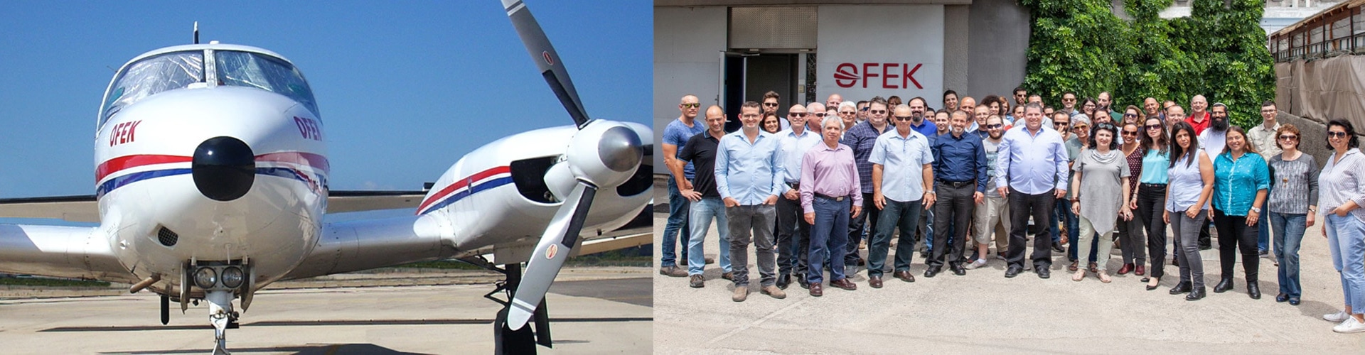
About Ofek Aerial Photography
For more than 30 years, Ofek Aerial Photography is one of the leading companies in Europe in the fields of aerial and satellite mapping, geographic data collection and processing, and in the provision of services in numerous geographic applications.
In a technological age that develops at a dynamic pace, Ofek Aerial Photography invests heavily in one of the most advanced technological infrastructures in the world. The company offers a variety of unique products and services in local and global markets, with the aim of providing complete and comprehensive solutions to its customers in Israel and worldwide.
Ofek owns a range of the most advanced mapping systems in the world, suitable for providing a variety of mapping and remote sensing services, including:
- Vexcel UltraCam Eagle aerial mapping system.
- VisionMap A3 Digital Mapping Camera.
- A three-dimensional photography system that includes 5 cutting-edge cameras.
- LiDAR - an airborne laser system for precise topographical mapping.
- Mobile Mapper - A 3D mapping system installed on a dedicated vehicle for collection purposes using a LiDAR (laser) system + 360° photography while in motion.
- Satellite imagery - Ofek has agreements with all major commercial satellite companies around the world, enabling it to provide its customers with a variety of quality satellite images for a range of purposes.
Ofek employs about 100 professionals in a variety of specialty areas, among them: geodetic engineers, software experts, geographers, aerial photo interpreters, pilots and navigators.
The company maintains a certified quality management system in compliance with the international standard: ISO 9001:2008.
Ofek Aerial Photography has set itself the goal of providing quality and professional services to its customers in Israel and around the world.
Vision
Ofek Aerial Photography's vision is based on a number of key core values that lead all of the company's operations in Israel and around the world:
-

Service
We focus on our customers in Israel and abroad, while listening to their needs and providing the most appropriate solutions based on reliability and transparency, in order to provide the best products and the maximum added value for them.
-

Professionalism
To continue to lead the field of collecting and processing geographic information in Israel and abroad, while constantly striving for innovation, professionalism and creativity.
-

Human capital
Our employees are the most important human resource in moving the company forward and achieving its goals. We strive to promote and nurture every worker and employee in the professional and personal aspects, to challenge and encourage excellence, cooperation and patience.
-

Innovation
To invest in a broad technological infrastructure, using the most advanced tools in the field of geographic information, which will provide our customers with a wide range of services and professional solutions.
Management
-
 Ehud Friedlander Chairman & Owner
 -
Dror Morad CEO
-
 Galit Kedem VP Finance
 -
 Yaniv Weisberg Lotan VP Sales & Marketing
 -
 Oded Ephrat International Division Manager
 -
 Yossi Glazen COO
 -
 Roy Lanes Air Operations Division Director
 -
 Yariv Casif Chief Surveyor
 -
 Shaul Avni Head Pilot
Ofek Group
-

Ofek Art was established in 1996 as a professional laboratory for image processing and printing services, and is part of Ofek Aerial Photography Group.
Since its inception, Ofek Art has excelled in its high professional and technological level and is considered a company that has set new and high standards in the field of image processing and printing. Ofek Art was a significant factor in the change in the field of photographic printing - from analogue printing to digital printing with high-quality prints in the Fine Art format. Recently, the laboratory was expanded to print on hard surfaces such as wood, glass and PVC, using the sophisticated Japanese Mimaki printing system.
The laboratory offers a wide range of products and services, beginning from the collection through the scanning and the testing, and up to finishing and framing stage, including installation in the field and shipments throughout the country and worldwide.
To date, Ofek Art has participated in thousands of exhibitions, in museums and visitor centers throughout Israel and abroad, and we see the process of producing the exhibition as a shared experience for the artist, the curator and us as service providers.
Go to Company’s website -

Geo-Point Ltd. of the Ofek Aerial Photography Group, headed by Dr. Judd Jaroush (Ph.D), a world-class expert and lecturer at the Technion and in leading academic institutions around the world in geodetic engineering, cadastre and civil engineering.
The company specializes in geodetic engineering, ground surveying, cadastre, real estate, geo-technology, and civil transportation engineering. Geo-Point offers its clients combined air and ground based solutions while maintaining product quality and cost-efficiency.
The company owns state-of-the-art software and geodetic & engineering measuring instruments with the most advanced technological characteristics in the world. Business cooperation with Omantic Ltd. also exposes Geo Point to a range of innovative technological solutions and tools in the field, enabling it to use them to identify, locate and provide solutions to various problems.
These technologies provide the company's employees with the tools to carry out their work and provide service to customers in the fastest and highest quality manner. The combination of technology, skilled & professional personnel and direct contact with the academy for research purposes, provide the company's customers with a rich and unique product portfolio.
Go to Company’s website
Our Customers
For more than 30 years, Ofek has been providing Geospatial solutions for governments, municipal authorities, public entities and commercial customers in the fields of: Land Administration, GIS, engineering, urban planning, 3D city modeling, infrastructure and utilities, homeland security, defense, agriculture and forestry, mineral exploration, industry, real estate and more.